Welcome to The Reef Authority
Great Barrier Reef Marine Park Authority
Please use this identifier to cite or link to this item:
https://hdl.handle.net/11017/3503

| Title: | Location of Maritime Cultural Heritage Protection Special Management Area in the Frankland Islands region |
| Authors: | Spatial Data Centre |
| metadata.dc.subject.location: | Cairns/Cooktown Management Area |
| metadata.dc.subject.category: | Cultural heritage Zones, plans and maps |
| Year of publication: | 2016 |
| Publisher: | Great Barrier Reef Marine Park Authority |
| Series/Report no.: | Special Management Areas |
| Description: | SDC140501a. This map is indicative only. |
| URI: | https://hdl.handle.net/11017/3503 |
| Type of document: | Map |
| Appears in Collections: | Management |
Files in This Item:
| File | Description | Size | Format | |
|---|---|---|---|---|
| 140501a-FranklandsCatalina-A24-25SMA-MediaMap.pdf | Map (PDF) | 183.92 kB | Adobe PDF | 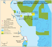 View/Open |
Items in ELibrary are protected by copyright, with all rights reserved, unless otherwise indicated.