Welcome to The Reef Authority
Great Barrier Reef Marine Park Authority
Please use this identifier to cite or link to this item:
https://hdl.handle.net/11017/3502

Full metadata record
| DC Field | Value | Language |
|---|---|---|
| dc.coverage.spatial | Abbot Point | en |
| dc.coverage.spatial | Gloucester Island | en |
| dc.coverage.spatial | Holbourne Island | en |
| dc.date.accessioned | 2019-09-17T23:30:52Z | - |
| dc.date.available | 2019-09-17T23:30:52Z | - |
| dc.date.copyright | 2016 | en |
| dc.date.issued | 2016 | en |
| dc.identifier.uri | https://hdl.handle.net/11017/3502 | - |
| dc.description | SDC130921a. This map is indicative only. | en |
| dc.publisher | Great Barrier Reef Marine Park Authority | en |
| dc.relation.ispartofseries | Special Management Areas | en |
| dc.rights | © Commonwealth of Australia (GBRMPA) | en |
| dc.title | Location of Maritime Cultural Heritage Protection Special Management Area in the Bowen region | en |
| dc.type | Map | en |
| dc.format.pages | 1 | en |
| dc.contributor.corpauthor | Spatial Data Centre | en |
| dc.publisher.place | Townsville | en |
| dc.subject.collection | Managing Multiple Use | en |
| dc.relation.connectiontogbrmpa | GBRMPA published this item | en |
| dc.subject.category | Cultural heritage | en |
| dc.subject.category | Zones, plans and maps | en |
| dc.subject.location | Townsville/Whitsunday Management Area | en |
| dc.keywords | SMA | en |
| dc.keywords | Catalina | en |
| Appears in Collections: | Management | |
Files in This Item:
| File | Description | Size | Format | |
|---|---|---|---|---|
| 130921a-BowenCatalina-A24-24SMA-MediaMap.pdf | Map (PDF) | 219.54 kB | Adobe PDF | 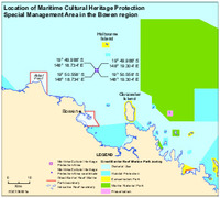 View/Open |
Items in ELibrary are protected by copyright, with all rights reserved, unless otherwise indicated.