Welcome to The Reef Authority
Great Barrier Reef Marine Park Authority
Please use this identifier to cite or link to this item:
https://hdl.handle.net/11017/156

| Title: | Mapping reef health using Google Earth: supporting management responses to climate change incidents |
| Authors: | Great Barrier Reef Marine Park Authority |
| Keywords: | Great Barrier Reef (Qld.)-Climate |
| metadata.dc.subject.asfa: | Climatic changes Spatial analysis Ecosystem resilience |
| APAIS Subject: | Environmental management Mapping |
| metadata.dc.subject.category: | Climate change |
| Year of publication: | 2010 |
| Publisher: | Great Barrier Reef Marine Park Authority |
| Series/Report no.: | Climate change project bulletin |
| Abstract: | The newly developed Reef Health spatial mapping tool captures and displays data from the Great Barrier Reef Marine Park Authority’s (GBRMPAs) impact monitoring programs as a colour coded layer in Google Earth. The maps will improve understanding of the relationships between impacts and environmental stress, coral health, resilience and recovery in the Great Barrier Reef Marine Park. |
| URI: | https://hdl.handle.net/11017/156 |
| Type of document: | Brochure |
| Appears in Collections: | Effects |
Files in This Item:
| File | Description | Size | Format | |
|---|---|---|---|---|
| Mapping-Reef-health-using-Google-Earth-Supporting-management-responses-to-climate-change-incidents.pdf | 1.64 MB | Adobe PDF | 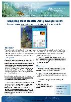 View/Open |
Items in ELibrary are protected by copyright, with all rights reserved, unless otherwise indicated.