Skip navigation
Browse
Communities
& Collections
Browse Items by:
Year of publication
Author
Title
Date
Subject
Type
Series
Submit Date
Corporate
Governance
Agency organisational structure
Annual Reports
Corporate plans
GBR outlook report
Partnerships and agreements
Policies and position statements
Information Publication Scheme
Ecosystems
& Species
Animals
Plants
Ecosystems
Processes
Geographic features
Reef
Values
Cultural heritage
National heritage
Natural heritage
World heritage
Economic values
Social values
Managing
Multiple Use
Agriculture
Coastal development
Commercial fisheries
Defence
Illegal activity
Mining
Ports and shipping
Recreation
Research
Tourism
Traditional use
Leading environmental practice
Legislative tools
Permits and assessments
Zones, plans and maps
Effects
on the Reef
Climate change
Extreme events
Incidents
Water quality
Weeds, pests and disease
People
& Actions
Coastal communities
Councils
Farmers and graziers
Fishers
Miners
Recreational users
Reef managers
Schools
Tourism operators
Traditional owners
Sign on to:
My ELibrary
Receive email
updates
Edit Profile
Welcome to The Reef Authority
Great Barrier Reef Marine Park Authority
Reef Authority Digital Repository
Search
Search:
All of ELibrary
Staff Area
eLibrary
for
Current filters:
Title
Year of publication
Author
Type
Category
Equals
Contains
ID
Not Equals
Not Contains
Not ID
Title
Year of publication
Author
Type
Category
Equals
Contains
ID
Not Equals
Not Contains
Not ID
Start a new search
Add filters:
Use filters to refine the search results.
Title
Year of publication
Author
Type
Category
Equals
Contains
ID
Not Equals
Not Contains
Not ID
Results 1-20 of 23 (Search time: 0.007 seconds).
previous
1
2
next
Item hits:
View
Date
Title
Author(s)
Type
2006
Site Management Arrangements: Fitzroy Reef
Great Barrier Reef Marine Park Authority
Site Management Arrangements
2016
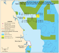
Location of Maritime Cultural Heritage Protection Special Management Area in the Frankland Islands region
Spatial Data Centre
Map
1997
Marine parks of Cape York : proposed zoning and management for the far northern section of the Great Barrier Reef Marine Park, and zoning for the proposed Cape York Marine Park
Great Barrier Reef Marine Park Authority
Report
2019
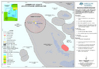
Sudbury Cay Locality (South Offshore Cairns Sector)
Spatial Data Centre
Map
2007
Eshelby Islands site plan
Great Barrier Reef Marine Park Authority
Site Plan
2007
Deloraine Island site plan
Great Barrier Reef Marine Park Authority
Site Plan
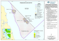
2019
Frankland Islands Sector
Spatial Data Centre
Map
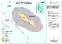
2019
Snapper Island Reef Location (Offshore Port Douglas Sector)
Spatial Data Centre
Map
2019
Agincourt Reef (Offshore Port Douglas Sector)
Spatial Data Centre
Map
1999
Marine parks of the Byfield coast and Port Clinton: proposed zoning for the Gumoo Woojabuddee section and zoning of the proposed Gumoo Woojabuddee Marine Park
Great Barrier Reef Marine Park Authority
Report
2007
Cow and Calf Islands site plan
Great Barrier Reef Marine Park Authority
Site Plan
2019
Low Island Locality (Offshore Port Douglas Sector)
Spatial Data Centre
Map
2007
Double Bay (East) site plan
Great Barrier Reef Marine Park Authority
Site Plan
2019
Moore Reef (South Offshore Sector)
Spatial Data Centre
Map
2014
Great Barrier Reef Region Strategic Assessment: Program report
Great Barrier Reef Marine Park Authority
Report
2019
Hope Islands Reefs (Offshore Port Douglas Sector)
Spatial Data Centre
Map
2019
Green Island Reef Location (Offshore Cairns Sector)
Spatial Data Centre
Map
2007
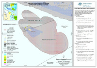
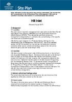
Hill Inlet site plan
Great Barrier Reef Marine Park Authority
Site Plan
2008
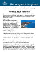
Site Management Arrangements: Bauer Bay, South Molle Island
Great Barrier Reef Marine Park Authority
Site Management Arrangements
2007
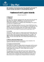
Haslewood and Lupton Island site plan
Great Barrier Reef Marine Park Authority
Site Plan
Results 1-20 of 23 (Search time: 0.007 seconds).
previous
1
2
next
Discover
Year of publication
1
2020 - 2029
20
2010 - 2019
2
1997 - 1999
Author
12
Great Barrier Reef Marine Park Au...
11
Spatial Data Centre
Type
11
Map
6
Site Plan
3
Report
2
Site Management Arrangements
1
Guidelines
Category
17
Natural heritage
6
Information Publication Scheme
4
Legislative tools
2
Animals
2
Economic values
2
Leading environmental practice
2
Permits and assessments
2
Recreation
2
Tourism
2
World heritage
.
next >