Skip navigation
Browse
Communities
& Collections
Browse Items by:
Issue Date
Author
Title
Subject
Series
Type
Submit Date
Corporate
Governance
Employee Census Highlights Report
Agency organisational structure
Annual Reports
Corporate plans
GBR outlook report
Partnerships and agreements
Policies and position statements
Information Publication Scheme
Ecosystems
& Species
Animals
Plants
Ecosystems
Processes
Geographic features
Reef
Values
Cultural heritage
National heritage
Natural heritage
World heritage
Economic values
Social values
Managing
Multiple Use
Agriculture
Coastal development
Commercial fisheries
Defence
Illegal activity
Mining
Ports and shipping
Recreation
Research
Tourism
Traditional use
Leading environmental practice
Legislative tools
Permits and assessments
Zones, plans and maps
Effects
on the Reef
Climate change
Extreme events
Incidents
Water quality
Weeds, pests and disease
People
& Actions
Coastal communities
Councils
Farmers and graziers
Fishers
Miners
Recreational users
Reef managers
Schools
Tourism operators
Traditional owners
Sign on to:
My ELibrary
Receive email
updates
Edit Profile
GBRMPA ELibrary
Search
Search:
All of ELibrary
eLibrary
Reef joint field management programme
Staff Area
for
Current filters:
Title
Author
Category
Date Issued
Equals
Contains
ID
Not Equals
Not Contains
Not ID
Title
Author
Category
Date Issued
Equals
Contains
ID
Not Equals
Not Contains
Not ID
Start a new search
Add filters:
Use filters to refine the search results.
Title
Author
Category
Date Issued
Equals
Contains
ID
Not Equals
Not Contains
Not ID
Results 1-20 of 73 (Search time: 0.003 seconds).
previous
1
2
3
4
next
Item hits:
Preview
Issue Date
Title
Author(s)
2016
Light thresholds for seagrasses of the GBRWHA: a synthesis and guiding document. Including knowledge gaps and future priorities
Collier, C.J.
;
Chartrand, K.
;
Honchin, C.
;
Fletcher, A.
;
Rasheed, M.
2014
Aerial coastal view of Aeroglen, Cairns [video footage]
Jumbo Aerial Photography
2011
Reef Health Incident Response System 2011 (SUPERSEDED)
Great Barrier Reef Marine Park Authority
2011
Coral Disease Risk and Impact Assessment Plan 2011 (SUPERSEDED)
Great Barrier Reef Marine Park Authority
2010
Classifying the biodiversity of the Great Barrier Reef World Heritage Area for the classification phase of the representative areas program
Kerrigan, B.A.
;
Breen, D.
;
De'ath, G.
;
Day, J.
;
Fernandes, L.
;
Tobin, R.
;
Dobbs, K.
;
Great Barrier Reef Marine Park Authority
2011
Catchment to Reef Ecological Expert Advisory Workshop
Great Barrier Reef Marine Park Authority
2014
Aerial island view of Facing Island, Gladstone [video footage]
Jumbo Aerial Photography
2014
Aerial coastal and reefscape view from Dryander National Park to Grassy Island, Whitsunday region [video footage]
Jumbo Aerial Photography
2012
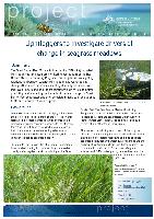
Lightloggers to investigate drivers of change in seagrass meadows
Great Barrier Reef Marine Park Authority
2014
Aerial island view of Tongue Point and Hill Inlet at Whitsunday Island [video footage]
Jumbo Aerial Photography
2014
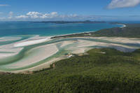
Aerial view of Hill Inlet at Whitsunday Island [photograph]
Jumbo Aerial Photography
2014
Aerial island view of Whitehaven Beach at Whitsunday Island [video footage]
Jumbo Aerial Photography
2012
Coastal Ecosystems Assessment Framework 2012
Great Barrier Reef Marine Park Authority
2012
Ecological workshop I
Great Barrier Reef Marine Park Authority
2013
Coastal ecosystems management - case study: water management
Great Barrier Reef Marine Park Authority
2012
Ecological risk assessment of the East Coast Otter Trawl Fishery in the Great Barrier Reef Marine Park: Technical report
Pears, R.J
;
Morison, A.K
;
Jebreen, E.J
;
Dunning, M.C
;
Pitcher, C.R
;
Courtney, A.J
;
Houlden, B
;
Jacobsen, I.P
2013
Coastal ecosystems management - case study: urban planning
Great Barrier Reef Marine Park Authority
2013
Coastal ecosystem management case study: fish connectivity
Holmes, G.
;
McGrath, C.
;
Larsen, J.
;
Hockings, M.
;
Moss, P.
2014
Great Barrier Reef Outlook Report 2014: In brief
Great Barrier Reef Marine Park Authority
2014
Great Barrier Reef Region Strategic Assessment: Strategic assessment report
Great Barrier Reef Marine Park Authority
Results 1-20 of 73 (Search time: 0.003 seconds).
previous
1
2
3
4
next
Discover
Author
8
Jumbo Aerial Photography
7
Schaffelke, B.
6
Costello, P.
6
Davidson, J.
5
Logan, M.
5
Thompson, A.
4
Gunn, K.
4
Uthicke, S.
3
Courtney, A.J
3
Devlin, M.
.
next >
Category
34
Water quality
29
Processes
22
Coastal communities
21
Animals
21
Farmers and graziers
20
Plants
17
Climate change
17
Coastal development
17
Councils
16
Agriculture
.
next >
Date issued
22
2013
17
2012
15
2014
8
2011
8
2016
2
2010
1
2015