Please use this identifier to cite or link to this item:
https://hdl.handle.net/11017/2901Coastal ecosystems management - case study: water management

View this entry
| Title: | Coastal ecosystems management - case study: water management |
| Authors: | Great Barrier Reef Marine Park Authority |
| ASFA Subjects: | Floodplains Coastal zone management Rivers |
| APAIS Subject: | Coasts Rivers |
| Location: | Townsville/Whitsunday Management Area |
| Category: | Ecosystems Processes Geographic features World heritage Agriculture Coastal development Mining Water quality Coastal communities Councils Farmers and graziers Miners |
| Issue Date: | 2013 |
| Publisher: | Great Barrier Reef Marine Park Authority |
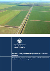
| Abstract: | The lower Burdekin is the largest floodplain system on the Australian east coast. It has a diverse assemblage of coastal ecosystems, including one of the greatest concentrations of wetlands situated in the Great Barrier Reef catchment. Given the magnitude of its physical, biogeochemical and biological process functions, it is an important functional component of the overall catchment of the Great Barrier Reef, and provides a host of ecological functions and processes for the Great Barrier Reef World Heritage Area (World Heritage Area). The lower Burdekin floodplain has been extensively developed to intensive irrigated agriculture. Sugarcane production systems dominate the floodplain ecosystem in terms of area and biophysical processes. The remaining remnant coastal ecosystems occur predominantly in areas not suitable for agricultural development, such as low lying and tidally influenced coastal margins. Remnant areas outside of the coastal margin include river and stream riparian corridors, intentionally retained vegetated corridors within the Burdekin Haughton Water Supply Scheme (BHWSS) area, inland floodplain areas outside the footprint of existing irrigation infrastructure, and small isolated and degraded remnants within the agricultural landscape. These remnant coastal ecosystems retain important physical, biogeochemical and biological processes but are under pressure due to the influence of the irrigated agriculture system, system-wide alteration of floodplain hydrology and pervasive threats posed by weeds and hot fire regimes. Alteration of floodplain hydrology is driven by large volume aseasonal flows of irrigation scheme tailwater, aquifer recharge operations and rising groundwater levels. Increased levels of nutrients, pesticides and sediment occur in run-off moving from production areas to receiving coastal ecosystems, including the waters of the Bowling Green Bay Ramsar site. |
| URI: | http://hdl.handle.net/11017/2901 |
| Type of document: | Report |
| Appears in Collections: | Effects |
Files in This Item:
| File | Description | Size | Format | |
|---|---|---|---|---|
| Case_study_water_planning_Burdekin.docx | Main report | 4.09 MB | Microsoft Word XML | View/Open |
| Case_study_water_planning_Burdekin.pdf | Main report | 3.06 MB | Adobe PDF |  View/Open |
Items in the ELibrary are protected by copyright, with all rights reserved, unless otherwise indicated.
