Welcome to The Reef Authority
Great Barrier Reef Marine Park Authority
Please use this identifier to cite or link to this item:
https://hdl.handle.net/11017/2900
Full metadata record
| DC Field | Value | Language |
|---|---|---|
| dc.coverage.spatial | Mount Peter | en |
| dc.coverage.spatial | Mulgrave River | en |
| dc.date.accessioned | 2014-11-28T01:41:06Z | - |
| dc.date.available | 2014-11-28T01:41:06Z | - |
| dc.date.copyright | 2013 | en |
| dc.date.issued | 2013 | en |
| dc.identifier.uri | https://hdl.handle.net/11017/2900 | - |
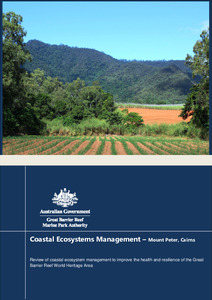
| dc.description.abstract | This report is one of five case studies examining how present management and planning decisions support protection of Great Barrier Reef coastal ecosystems with links to the Great Barrier Reef World Heritage Area’s (World Heritage Area) Outstanding Universal Value. This case study considers landscape management associated with previous Master Planning in the Mount Peter area of the Mulgrave-Russell catchment, far north Queensland. The Mount Peter case study site covers an area of 3,352 hectares, and was identified as a future urban development site under the repealed Far North Queensland Regional Plan 2009-2031. Much of the floodplain rainforest has been cleared from the site, and currently supports extensive agriculture (sugar cane), a quarry and small rural residential communities. The site is adjacent to the Wet Tropics World Heritage Area and the streams that cross the site discharge into the Trinity Inlet of the World Heritage Area. As noted in this review, managing for ecological function in modified landscapes (such as in the Mount Peter area) needs to consider soil infiltration rates, residence time of overland flow and there effect on sediment and nutrient run-off. These impacts are representative of many other Great Barrier Reef catchments and the management of them provides lessons for management of the Great Barrier Reef catchment. | en |
| dc.publisher | Great Barrier Reef Marine Park Authority | en |
| dc.title | Coastal ecosystems management - case study: urban planning | en |
| dc.type | Report | * |
| dc.subject.asfa | Catchment area | en |
| dc.subject.asfa | River basins | en |
| dc.format.pages | 43 | en |
| dc.contributor.corpauthor | Great Barrier Reef Marine Park Authority | en |
| dc.publisher.place | Townsville | en |
| dc.relation.connectiontogbrmpa | GBRMPA published this item | en |
| dc.subject.category | Ecosystems | en |
| dc.subject.category | Processes | en |
| dc.subject.category | Geographic features | en |
| dc.subject.category | World heritage | en |
| dc.subject.category | Social values | en |
| dc.subject.category | Coastal development | en |
| dc.subject.category | Water quality | en |
| dc.subject.category | Coastal communities | en |
| dc.subject.category | Councils | en |
| dc.subject.category | Farmers and graziers | en |
| dc.keywords | Coastal ecosystems | en |
| dc.keywords | Ecological function | en |
| dc.keywords | Coastal ecosystem management | en |
| dc.keywords | Coastal development | en |
| dc.keywords | Urban development | en |
| dc.keywords | Urban planning | en |
| dc.keywords | Wet Tropics | en |
| Appears in Collections: | Effects | |
Files in This Item:
| File | Description | Size | Format | |
|---|---|---|---|---|
| Case_study_urban_planning_Mt_Peter.docx | Main report | 10.48 MB | Microsoft Word XML | View/Open |
| Case_study_urban_planning_Mt_Peter.pdf | Main report | 2.7 MB | Adobe PDF |  View/Open |
Items in ELibrary are protected by copyright, with all rights reserved, unless otherwise indicated.