Please use this identifier to cite or link to this item:
https://hdl.handle.net/11017/277

Full metadata record
| DC Field | Value | Language |
|---|---|---|
| dc.contributor.author | Jupp, D.L.B. | * |
| dc.date.accessioned | 2012-05-25T02:31:59Z | en |
| dc.date.available | 2012-05-25T02:31:59Z | en |
| dc.date.copyright | 1986 | en |
| dc.date.issued | 1986 | en-US |
| dc.identifier.isbn | 9780642524492 | en |
| dc.identifier.uri | https://hdl.handle.net/11017/277 | en |
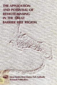
| dc.description.abstract | Water movements in the form of currents, internal waves, eddies and moving boundaries between water masses (oceanic fronts) are primary elements driving the Great Barrier Reef (GBR) system. The physical and chemical characteristics of the water column, as major factors in the short and long term development of the GBR biological system, subdivide the physical system into its component water masses. The material carried by the physical system consists of biota and suspended solids of natural (eg phytoplankton) and man induced (eg pollution) composition. Existing remote sensing devices provide an opportunity to gather valuable data on these dynamic physical and biological systems, and the complex of inter-reef communications they provide. Remote sensing by Landsat is already established as a tool for the establishment of a basic fixed-reef data base for the GBR. This (static) data base is effective for current inventory and many planning needs. However, future management within the GBR system must use an information base which does not neglect the essentially dynamic interdependency between the reef environments and the communities which exist within and between them. In the dynamic GBR physical system, events at whole GBR level may be as significant as events at within reef level. The problem of encompassing the wide range of time and space scales involved is one which only aircraft and satellite remote sensing in combination with ship and reef based studies can solve. This report addresses the way in which remote sensing opportunities exist to provide such integration and identifies a program of research and development which may achieve it. | en |
| dc.language.iso | en | en |
| dc.publisher | Great Barrier Reef Marine Park Authority | en |
| dc.relation.ispartofseries | Research publication series no. 6 | en |
| dc.relation.ispartofseries | Research publication | - |
| dc.subject | Landsat satellites | en |
| dc.subject | Remote sensing | en |
| dc.subject | Resource management - Queensland - Great Barrier Reef | en |
| dc.title | The application and potential of remote sensing in the Great Barrier Reef | en |
| dc.type | Report | en |
| dc.subject.asfa | Remote sensing | en |
| dc.subject.asfa | Coral reefs | en |
| dc.subject.asfa | Spatial analysis | en |
| dc.subject.asfa | Oceanography | en |
| dc.format.pages | 61 | en |
| dc.contributor.corpauthor | Great Barrier Reef Marine Park Authority | en |
| dc.subject.apais | Resource management | en |
| dc.subject.apais | Planning | en |
| dc.publisher.place | Townsville | en |
| dc.relation.connectiontogbrmpa | GBRMPA published this item | en |
| dc.subject.category | Processes | en |
| dc.subject.category | Research | en |
| dc.subject.theme | Managing Multiple Use | en |
| dc.subject.location | Reef-wide | en |
| dc.keywords | Landsat | en |
| Appears in Collections: | Management | |
Files in This Item:
| File | Description | Size | Format | |
|---|---|---|---|---|
| Application-potential-remote-sensing-GBR.pdf | PDF version | 57.09 MB | Adobe PDF |  View/Open |
Items in ELibrary are protected by copyright, with all rights reserved, unless otherwise indicated.
